Please note: Only the website content relating directly to the Paraguas project is available in Spanish. All other content on the UK CEH is in English.
How do the Páramos store water?
The role of plants and people
UK and Colombian scientists are collaborating on PARAGUAS, a project studying how the diversity of plants and activities of people contribute to the water regulation and provision of the Páramo, a unique mountain biome of the Northern Andes .
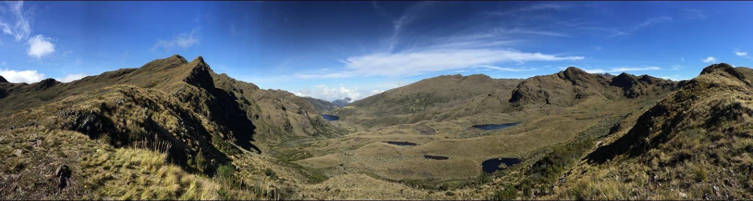
What are Páramos?
Páramos are unique and highly diverse high mountain grassland-peatland biomes found in the Northern Andean regions, covering a total area of 35,700km2. They are found in Colombia, Venezuela, Ecuador and Peru and are crucial for the livelihoods and wellbeing of millions of people. They are important spiritual landscapes, are the main source of water in these regions and are used for crop cultivation and grazing. They also contain a unique source of untapped genetic diversity.
While the Páramos have the potential to support local and regional development, through the exploitation of its biodiversity, the combined pressure of land use and climate change has already degraded many Páramo areas and their potential demise is a cause for concern for many, including local communities, regional and national policy and decision makers and researchers. All agree that any future exploitation requires a sustainable approach and that the management of these systems should enhance the Páramo’s resilience to climate change.
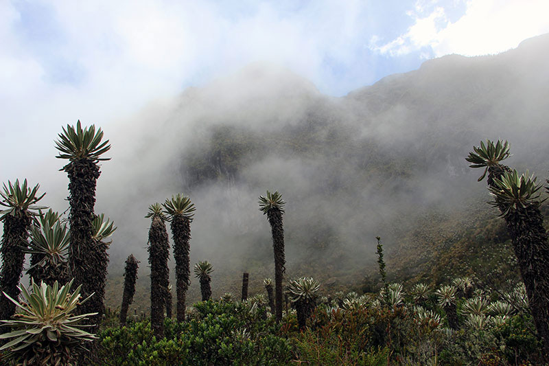
There is still very much which is not known about the functioning of the Páramos and without this knowledge there is a risk that interventions which are designed to achieve sustainability and enhance resilience are not effective or worse detrimental. Páramos are described as sponges that capture and store water from the atmosphere. Few quantitative studies have investigated the mechanisms behind this process and even less is known about the relative role of the plants and the soil of this complex system. Also, Páramos are socio-ecological systems that have been shaped by the human populations that have inhabited them over several centuries. This interaction is continuing to date with local communities relying solely on the Páramo for their livelihoods.
